Whether delivered remotely or on-site, these instructor-led live Geographic Information System (GIS) courses provide an interactive, hands-on experience. Participants will learn how to effectively capture, store, manipulate, analyze, manage, and present spatial or geographic data using GIS tools.
You can choose between “online live training” and “onsite live training.” Online live sessions (also referred to as “remote live training”) are conducted through an interactive remote desktop. Onsite live training can take place locally at your customer premises in Lyon or within NobleProg’s corporate training centers in Lyon.
NobleProg -- Your Local Training Provider
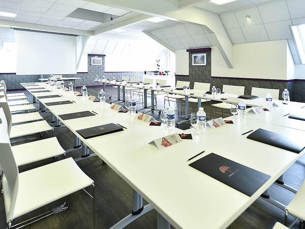
Lyon, Swisslife Tower
NobleProg Lyon, 10 Place Charles Béraudier, Lyon, france, 69000
Located 200 meters far from the train station TGV, Swisslife Tower is today the most representative building of this quarter of Lyon. The Business Center offers you a perfect location for your training.
Gares TGV
100meters from Gare TGV Part-Dieu , porte du Rhône Exit
Aéroport
30 minutes from Lyon Saint Exupéry (Satolas)
Rhône Express from Saint Exupéry airport (Terminus Gare part-Dieu)
This instructor-led program in Lyon empowers intermediate GIS professionals with expert-level ArcGIS Pro Plus competencies. Learners will acquire mastery in 3D modeling, advanced spatial analysis, and Python-driven automation to construct resilient geospatial workflows suitable for enterprise settings.
This instructor-led live training in Lyon (online or on-site) is designed for beginner to advanced GIS professionals and analysts who wish to learn how to effectively use ArcGIS for data visualization, spatial analysis, and geospatial project management.
By the end of this training, participants will be able to:
Navigate and utilize ArcGIS tools for geospatial data management.
Create and customize maps with layers and attributes.
Perform advanced spatial analysis and geoprocessing tasks.
This instructor-led, live training in Lyon (online or onsite) is aimed at advanced-level GIS professionals who wish to use ArcGIS Pro to enhance their spatial analysis capabilities, conduct comprehensive geostatistical analysis, and apply advanced 3D modeling techniques for more effective decision-making and problem-solving in real-world scenarios.
By the end of this training, participants will be able to:
Develop advanced skills in spatial analysis techniques using ArcGIS Pro.
Utilize Python scripting for automation and complex data processing.
Apply spatial modeling for problem-solving in real-world scenarios.
Conduct geostatistical analysis for advanced data interpretation.
Integrate external data sources and leverage 3D spatial data analysis.
This instructor-led live training, offered Lyon (online or onsite), is targeted at beginner-level IT support professionals seeking to deliver reliable support for ArcGIS Enterprise and effectively address system anomalies or failures.
By the end of this training, participants will be able to:
Understand the architecture and core components of ArcGIS Enterprise.
Install, configure, and manage ArcGIS Enterprise.
Develop skills to troubleshoot and resolve common issues.
Gain proficiency in monitoring and maintaining ArcGIS Enterprise environments.
Master techniques for backup, recovery, and performance optimization.
This instructor-led live training in Lyon (online or onsite) is designed for beginner-level professionals who want to master the foundational concepts and tools of ArcGIS.
By the end of this course, participants will be able to:
Grasp fundamental GIS and spatial data principles.
This instructor-led, live training in Lyon (online or onsite) is aimed at beginner-level earth sciences and engineering professionals who wish to use Python for geospatial analysis in both ArcGIS and QGIS environments.
By the end of this training, participants will be able to:
Learn Python syntax and control structures for executing geospatial tasks efficiently.
Use Pandas, Numpy, and Matplotlib for data analysis and visualization in GIS.
Manipulate and analyze vector data with Geopandas, Arcpy, and PyQGIS libraries.
Automate geospatial processes and workflows using Python scripting in ArcGIS and QGIS.
Develop custom Python-based geoprocessing tools for ArcGIS and QGIS to streamline tasks.
This instructor-led, live training in Lyon (online or onsite) is designed for intermediate-level geographers seeking to deepen their expertise in spatial analysis, data management, and GIS applications.
By the end of this training, participants will be able to:
Apply advanced spatial analysis techniques to solve complex geographical problems.
Manage large spatial databases and perform data quality control.
Create dynamic and interactive maps and visualizations for various applications.
Utilize programming and automation to streamline GIS workflows.
This instructor-led, live training in Lyon (online or onsite) is targeted at field ecologists and conservation managers who want to develop spatial data projects using ArcGIS.
By the end of this training, participants will be able to:
Output spatial data as visualizations.
Conduct geostatics on actual data.
Implement spatial data analysis, data processing, and mapping with ArcGIS.
In the dynamic energy industry, combining electrical transient analysis with accurate geographic data has become a strategic imperative. Relying on disjointed information currently exposes operations to substantial risks. This intensive 14-day course in Melbourne is crafted to connect electrical engineering expertise with geospatial management.
In Lyon, this course offers a comprehensive introduction to QGIS, focusing on spatial data analysis, map creation, and layer management. It also covers PyQGIS for advanced Python integration and plugin development, providing participants with practical GIS skills.
Read more...
Last Updated:
Testimonials (4)
Learning that the QGIS and a tool that can used by other different professionals such land survey
Bame Duncan Koko - Bentel Technologies (Pty) Ltd
Course - QGIS for Geographic Information System
How to use open satellites data for real applications
Tshering Dorji - Druk Holding and Investments
Course - Advanced Geographic Information Systems (GIS)
Hands-on examples allowed us to get an actual feel for how the program works. Good explanations and integration of theoretical concepts and how they relate to practical applications.
Ian - Archeoworks Inc.
Course - ArcGIS Fundamentals
Radomir was very patient and helpful when I got stuck. He was very knowledgeable about the subject matter, and his explanations on different concepts were detailed and thorough.
Online Geographic Information System training in Lyon, GIS (Geographic Information System) training courses in Lyon, Weekend GIS courses in Lyon, Evening GIS training in Lyon, GIS instructor-led in Lyon, GIS instructor-led in Lyon, GIS one on one training in Lyon, GIS private courses in Lyon, GIS (Geographic Information System) instructor in Lyon, Evening GIS (Geographic Information System) courses in Lyon, GIS trainer in Lyon, GIS on-site in Lyon, Online GIS training in Lyon, Weekend GIS training in Lyon, GIS boot camp in Lyon, Geographic Information System classes in Lyon, Geographic Information System coaching in Lyon