Online or onsite, instructor-led live Spatial Analysis (also known as Spatial Statistics, Spatial Analytics, Geospatial Analysis, Geospatial Analytics, Geo-Spatial Analysis, and Geo-Spatial Analytics) training courses demonstrate through interactive discussion and hands-on practice how such analysis employs software capable of rendering maps, processing spatial data, and applying analytical methods to terrestrial or geographic datasets, including the use of geographic information systems and geomatics.
Spatial Analysis training is available as "online live training" or "onsite live training". Online live training (aka "remote live training") is carried out by way of an interactive, remote desktop. Onsite live Spatial Analysis trainings in Nantes can be carried out locally on customer premises or in NobleProg corporate training centers.
NobleProg -- Your Local Training Provider
Nantes, Zenith
NobleProg Nantes, 4 rue Edith Piaf, Saint-Herblain, france, 44821
In the Parc d'Ar Mor zone, near the Zénith.
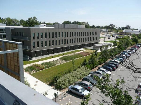
Car : from the ring road, Porte de Chézine Exit> Boulevard du Zenith > Esplanade Georges Brassens (restaurants) > Rue Edith Piaf on the right. From the N444 road (Nantes > Lorient), Exit #1 > boulevard Marcel Paul > Rue Edith Piaf at the right.
Parking Zénith P1 (free). Once parked, you can recognize the building: it's one of the tree bulding with zinc frontage.
Bicycle: free indoor parking
Public transport :
Tramway R1, Schoelcher station + 10 mn by foot through commercial center Atlantis
Tramway R1, François Mitterrand stop + bus 50, stop at Saulzaie station or bus 71, stop at the Zénith station
Tramway R3, Marcel Paul station + bus 50, Saulzaie station
Chronobus C6, Hermeland station+ bus 71, Zénith station
Bus : lignes 50 (Saulzaie station) or 71 (Zénith station)
ArcGIS Pro Plus represents an advanced tier of the ArcGIS Pro platform, delivering extended capabilities for geospatial data analysis, three-dimensional modeling, workflow automation, and enterprise-level collaboration.
This instructor-led training, available in online or onsite formats, is designed for intermediate GIS professionals seeking to enhance their expertise in spatial data analysis, automation, and data sharing using the tools provided by ArcGIS Pro Plus.
Upon completion of this training, participants will be equipped to:
Utilize ArcGIS Pro Plus tools effectively for data visualization and analytical processes.
Develop 2D and 3D maps employing advanced symbology and sophisticated geoprocessing techniques.
Streamline workflows through the use of ModelBuilder and Python scripting.
Seamlessly integrate ArcGIS with external data services and enterprise systems.
Course Format
Interactive lectures paired with group discussions.
Extensive exercises and practical application opportunities.
Hands-on implementation within a live laboratory environment.
Options for Course Customization
For those interested in a tailored training experience for this course, please reach out to us to make the necessary arrangements.
This instructor-led live training in Nantes (online or on-site) is designed for beginner to advanced GIS professionals and analysts who wish to learn how to effectively use ArcGIS for data visualization, spatial analysis, and geospatial project management.
By the end of this training, participants will be able to:
Navigate and utilize ArcGIS tools for geospatial data management.
Create and customize maps with layers and attributes.
Perform advanced spatial analysis and geoprocessing tasks.
This instructor-led, live training in Nantes (online or onsite) is aimed at advanced-level GIS professionals who wish to use ArcGIS Pro to enhance their spatial analysis capabilities, conduct comprehensive geostatistical analysis, and apply advanced 3D modeling techniques for more effective decision-making and problem-solving in real-world scenarios.
By the end of this training, participants will be able to:
Develop advanced skills in spatial analysis techniques using ArcGIS Pro.
Utilize Python scripting for automation and complex data processing.
Apply spatial modeling for problem-solving in real-world scenarios.
Conduct geostatistical analysis for advanced data interpretation.
Integrate external data sources and leverage 3D spatial data analysis.
This instructor-led live training, offered Nantes (online or onsite), is targeted at beginner-level IT support professionals seeking to deliver reliable support for ArcGIS Enterprise and effectively address system anomalies or failures.
By the end of this training, participants will be able to:
Understand the architecture and core components of ArcGIS Enterprise.
Install, configure, and manage ArcGIS Enterprise.
Develop skills to troubleshoot and resolve common issues.
Gain proficiency in monitoring and maintaining ArcGIS Enterprise environments.
Master techniques for backup, recovery, and performance optimization.
This instructor-led, live training in Nantes (online or onsite) is designed for beginner-level professionals who want to master the fundamental concepts and tools of ArcGIS.
Upon completion of this training, participants will be able to:
Grasp the core principles of GIS and spatial data.
This instructor-led, live training in Nantes (online or onsite) is aimed at beginner-level earth sciences and engineering professionals who wish to use Python for geospatial analysis in both ArcGIS and QGIS environments.
By the end of this training, participants will be able to:
Learn Python syntax and control structures for executing geospatial tasks efficiently.
Use Pandas, Numpy, and Matplotlib for data analysis and visualization in GIS.
Manipulate and analyze vector data with Geopandas, Arcpy, and PyQGIS libraries.
Automate geospatial processes and workflows using Python scripting in ArcGIS and QGIS.
Develop custom Python-based geoprocessing tools for ArcGIS and QGIS to streamline tasks.
This instructor-led, live training in Nantes (online or onsite) targets intermediate-level environmental scientists and archaeologists who wish to learn how to use ArcMap in ArcGIS for collecting, organizing, managing, and analyzing geographic information.
Upon completion of this training, participants will be able to:
Grasp the fundamentals of ArcMap and ArcGIS.
Collect, organize, manage, and analyze geographic information related to social and archaeological elements.
This instructor-led, live training in Nantes (online or onsite) is designed for intermediate-level geographers seeking to deepen their expertise in spatial analysis, data management, and GIS applications.
By the end of this training, participants will be able to:
Apply advanced spatial analysis techniques to solve complex geographical problems.
Manage large spatial databases and perform data quality control.
Create dynamic and interactive maps and visualizations for various applications.
Utilize programming and automation to streamline GIS workflows.
Pix4D Matic and Pix4D Survey are advanced tools for photogrammetry and geospatial data, essential for high-precision mapping, terrain modeling, and analysis.
This instructor-led live training, available online or onsite, targets beginner to intermediate geospatial professionals eager to process, analyze, and derive actionable insights from drone data using Pix4D Matic and Pix4D Survey.
Upon completion of this training, participants will be able to:
Manage large-scale photogrammetry projects using Pix4D Matic.
Create orthophotos, digital terrain models, and contour lines.
Clean and vectorize point cloud data with Pix4D Survey.
Extract and export key geospatial deliverables for geological or civil analysis.
Course Format
Interactive lectures and discussions.
Practical exercises using real-world datasets.
Guided project work and output interpretation.
Customization Options
For customized training arrangements, please contact us.
This instructor-led, live training in Nantes (online or onsite) is targeted at field ecologists and conservation managers who want to develop spatial data projects using ArcGIS.
By the end of this training, participants will be able to:
Output spatial data as visualizations.
Conduct geostatics on actual data.
Implement spatial data analysis, data processing, and mapping with ArcGIS.
This instructor-led, live training session in Nantes (online or onsite) is aimed at GIS analysts who wish to automate repetitive tasks in GIS processes.
By the end of this training, participants will be able to:
Build GIS applications using Python and ArcGIS tools.
Develop with the ArcGIS package ArcPy, using Python.
Apply the ArcGIS modules for map automation using object classes in Python.
In the rapidly changing energy landscape, combining electrical transient analysis with accurate geographic data has become a strategic imperative. Currently, relying on disjointed data creates significant operational risks. This 14-day intensive program in Melbourne aims to bridge the divide between electrical engineering and geospatial management.
This instructor-led live training in Nantes (online or onsite) is aimed at developers who wish to enhance their website or web application by adding geolocation functionality through Google Maps.
By the end of this training, participants will be able to:
Embed a map into a new or existing website or web application.
Display live data that synchronizes with the current location.
This instructor-led, live training in Nantes (online or onsite) is aimed at field ecologists and conservation managers who wish to post-process Pix4D drone data.
By the end of this training, participants will be able to:
Implement Google Earth to enhance UAV mapping.
Use outputs of images to generate reports.
Post-process with GIS and CAD software for advanced drone data modeling.
This instructor-led, live training in Nantes (online or onsite) is tailored for field ecologists and conservation managers who wish to perform land surveying and drone mapping using Pix4D.
Upon completion of this training, participants will be able to:
Utilize end-to-end drone mapping processes and techniques.
Achieve high surveying accuracy.
Understand the fundamentals of global coordinate systems and GPS.
Generate and analyze survey output using Pix4D's image processing software.
A geographic information system (GIS) is a system designed to capture, store, manipulate, analyze, manage, and present spatial or geographic data. The acronym GIS is sometimes used for geographic information science (GIScience) to refer to the academic discipline that studies geographic information systems and is a large domain within the broader academic discipline of geoinformatics.
QGIS functions as geographic information system (GIS) software, allowing users to analyze and edit spatial information, in addition to composing and exporting graphical maps. QGIS supports both raster and vector layers; vector data is stored as either point, line, or polygon features. Multiple formats of raster images are supported, and the software can georeference images. To summarize it allows the users to create, edit, visualise, analyse and publish geospatial information on Windows, Mac, Linux, BSD.
This program, in its first phase, introduces the QGIS interface for general usage. In the second phase, we introduce PyQGIS - the python libraries of QGIS that allows the integration of GIS functionalities in your python code or your python application, so that you may even create your own Python Plugin around a particular GIS functionality.
Online Spatial Statistics training in Nantes, Spatial Analytics training courses in Nantes, Weekend Geo-Spatial Analytics courses in Nantes, Evening Spatial Analytics training in Nantes, Geo-Spatial Analysis instructor-led in Nantes, Spatial Statistics trainer in Nantes, Geo-Spatial Analysis classes in Nantes, Geospatial Analysis coaching in Nantes, Spatial Statistics boot camp in Nantes, Geospatial Analytics instructor-led in Nantes, Geospatial Analysis on-site in Nantes, Spatial Statistics one on one training in Nantes, Spatial Statistics instructor in Nantes, Online Geospatial Analytics training in Nantes, Weekend Geo-Spatial Analysis training in Nantes, Geo-Spatial Analysis private courses in Nantes, Evening Spatial Analysis courses in Nantes