NobleProg Orléans, 43 Avenue de Paris, Orléans, france, 45000
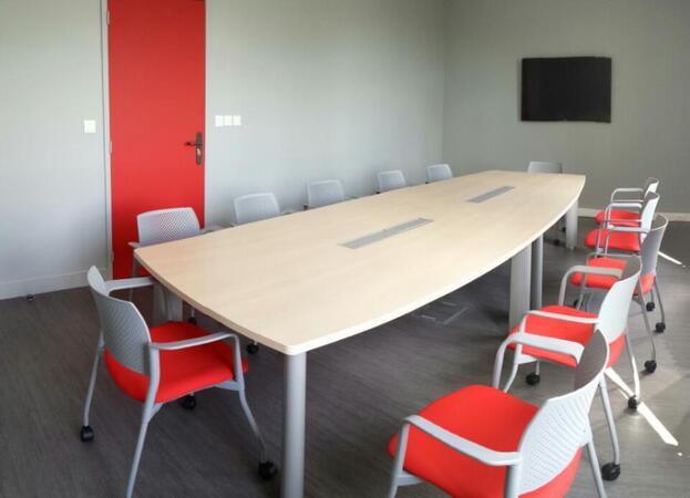
La Factory offers renovated offices in the heart of the city of Orléans, near the Central Station. Train, tram, buses, and shops are near the building (with elevator). There are 300 m² of offices, Factory offers shared offices and individual offices for 1 to 5 people, equipped or not. The offices are very bright (natural light), and have just been renovated in a "design spirit". Services include ADSL Internet via wifi, a large meeting room. All charges are included: electricity, heating, internet, common areas. It is possible to obtain many additional services: direct debit, telephone line, parking, access 24/24 and 7/7 days ... La Factory is also a service for direct debit and rental of the meeting room for external companies Nonresidents. The meeting room (32 m² / 12 seats), like the other offices, has just been renovated. Services include ADSL Internet via wifi and other charges (electricity, heating, cleaning). Many services are also available, on demand: video projector, coffee machine with pods, tea, chocolate, catering service, drinks, conference call service.