Online or onsite, instructor-led live QGIS training courses in Toulouse.
Toulouse, City Center
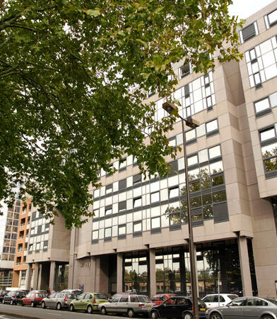
Mutliburo Toulouse, 9 Rue de Sébastopol, Toulouse, france, 31000
The business center is located in the Compans business district on the edge of Compans Caffarelli Park, which extends over...
The business center is located in the Compans business district on the edge of Compans Caffarelli Park, which extends over 10 hectares.
Many businesses have settled in this area, attracted both by the situation between the historic heart and the ring road that leads to the airport and the modernity of the site. Note the proximity of the conference center of Toulouse.
The business center offers its fully equipped offices and 2 meeting rooms to organize trainings and business meetings. All rooms are air-conditioned. Your visitors will be welcomed by our teams who will organize your day (preparation of rooms, internet connections, coffee break, catering, secretarial, hotel booking
A geographic information system (GIS) is a system designed to capture, store, manipulate, analyze, manage, and present spatial or geographic data. The acronym GIS is sometimes used for geographic information science (GIScience) to refer to the academic discipline that studies geographic information systems and is a large domain within the broader academic discipline of geoinformatics.
QGIS functions as geographic information system (GIS) software, allowing users to analyze and edit spatial information, in addition to composing and exporting graphical maps. QGIS supports both raster and vector layers; vector data is stored as either point, line, or polygon features. Multiple formats of raster images are supported, and the software can georeference images. To summarize it allows the users to Create, edit, visualise, analyse and publish geospatial information on Windows, Mac, Linux, BSD.
This program, in its first phase, introduces the QGIS interface for general usage. In the second phase, we introduce PyQGIS - the python libraries of QGIS that allows the integration of GIS functionalities in your python code or your python application, so that you may even create your own Python Plugin around a particular GIS functionality.
Read more...
Last Updated:
Testimonials (1)
The trainer adapted the materials and contents to what he thought would be best for us and he succeeded. The quality of the training was excellent.
Online QGIS training in Toulouse, QGIS training courses in Toulouse, Weekend QGIS courses in Toulouse, Evening QGIS training in Toulouse, QGIS instructor-led in Toulouse, QGIS trainer in Toulouse, Weekend QGIS training in Toulouse, QGIS coaching in Toulouse, QGIS private courses in Toulouse, QGIS boot camp in Toulouse, Evening QGIS courses in Toulouse, QGIS instructor in Toulouse, QGIS instructor-led in Toulouse, QGIS one on one training in Toulouse, Online QGIS training in Toulouse, QGIS classes in Toulouse, QGIS on-site in Toulouse